 The waiting is over. The tarmac at Palmer was
still wet from the night's rain. Checking the METAF, we were promised a
window of good weather over the next few days. Occasionally some low
clouds and fog from the days before scattered around the airport.
Talkeetna, the airstrip near Denali Park, reported broken overcast
with a trend toward clearing. Our group could not be held back. Some chose
the low level route down the valley and then, when in the clear north of
Anchorage they would turn north. Others, however, were longing for the
blue sky and climbed through the broken overcast. John Dale (our group
leader) ahead,
advised the climbers among us to head for 8-10'000ft. Weaving between the
cloud puffs we climbed at a steady rate and tried to study the map and
descriptions, hoping to prepare ourselves for what was to come.
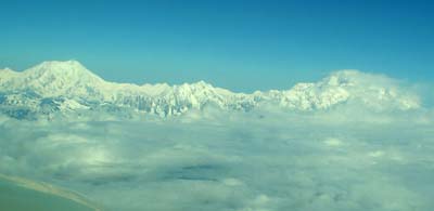 Suddenly
the clouds parted and in front of our eyes in the distance, the
magnificent Denali Range spread across our course. To the right was Mt.
McKinley, it's top partially in a veil of building clouds and to the left, the broad shoulder
of Mt. Foraker. In between the two giants stood the smaller Mt. Hunter. Our
company frequency became very busy all of the sudden. There were questions
about the wind, about reporting the positions on the published frequency
and of course, where were the others?
For most of us, the concern was the conflicting reports of heavy wind with the possibility of severe turbulence. Then there was the report from our friends in N210W who had arrived a little earlier and were flying near Mt. Mc Kinsley reporting smooth conditions. We pressed on -----
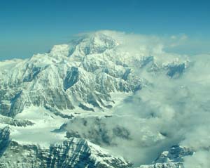 We
decided to be careful, got our oxygen going and kept climbing until we
reached 17'500 ft. Even here in Alaska Class A airspace starts at 18'000
ft. The layer of clouds were soon left behind and we enjoyed the clear and
calm air as we approached the majestic mountains.
Mt. McKinley, 20'320 ft tall (6'194m) had a cloudy cap but nothing could conceal the wild, magnificent structure of this mountain, the highest in North America which boasts of the steepest continual ice wall of over 14,000 ft. It is so easy to climb near the summit with our aircraft but how immensely harder and daring must it be to climb this mammoth giant of a rock covered in snow and ice all year.
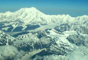 Mt.
Foraker to the southwest is only 17'400 ft (5'303 m). Only a small flag
of a cloud hung from the peak. Wind tossed snow vanes were hardly visible.
So we decided to keep a little closer to that sector of the range.
On the reporting frequency was constant chatter, apparently from local pilots who did not seem to care that other aircraft were in the area. Nothing indicated that there was a danger of turbulence. (Was that message spread to keep "outsiders" away?) Nobody reported an altitude close to ours, thus we considered ourselves no obstacle.
 From
between the steep cliffs near the peaks, small bands of ice flowed down the
slope, merging into an ever increasing river of ice. The glaciers looked like a
river frozen in time. The plateau near the top was fairly flat and smooth,
covered with snow and is up to three and a half miles wide. Then, as the
granite features of the mountain forced the
flow to turn and change shape, wide cracks and deep crevasses started to
appear.
Top of Kahiltna Glacier (8000ft msl) with Mt. McKinley to the right >>>
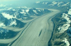 With
more glaciers joining the flow, they also brought gravel and rock along marking
their contribution. With joint strength, a new valley is carved into
the crust of the earth. Today Kahiltna Glacier measures 45 miles in
length and is Denali's largest body of ice. No amount of words can
describe the awesome sight.
<<< Lower end of Kahiltna Glacier disappearing to the south (1500 ft msl).
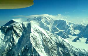 Cautiously
we rounded the southern flank of the range giving us a grand view of the
two tops. Mt. McKinley (background) showed its cap of clouds and the
typical lenticular clouds associated with strong high winds. Mt. Foraker
(foreground) showed only the typical clouds of wind blown snow hanging
downstream from the peaks. This, however, was enough of an indication to
stay clear of the possible wake turbulence on the leeward side.
After all, as in the local Athabascan language, Denali means "The high one", it is only wise to respect the wisdom and maintain a respectful distance. After all, our little aircraft is only a speck compared to the size and power of nature.
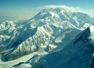 Rounding
Mt. Foraker a little further we gained a glimpse of the southern backside
of the range. More glaciers streamed from the mountain sides out towards
the northwestern planes. We decided that with the altitude restriction it
would take us too long to round the entire block of granite to the north
and as it appeared, a major part of the northern edge was covered by a
cloud blanket anyway. So we turned around, once more taking in the
breathtaking grandstand view and started our long descent from 17'500 ft
to Talkeetna, almost at sea level.
<<< Mt. McKinley with top of Straightaway Glacier (left foreground)
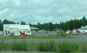
 Talkeetna
(PATK) is a very busy small airport with a special flair. Resembling almost a
bush camp you find many unique and sometimes exotic modifications of
popular aircraft. Many of them are equipped with skis or large tundra
tires. With a bank of clouds still hanging over the area it was not easy
to find the right hole through which to descend. -- Soon our group met
again at the local FBO. We were filled with emotions of what we have just
seen. It truly had been worthwhile to spend the few previous days
waiting.
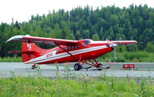 This
turbine powered Otter is representative of the many workhorses operating
from this airport which cannot speak of too many glorious days of good
weather throughout the year. We have been more than lucky to have hit one
of these days! It was truly, heaven sent!